 The name of mountin originates from friuli word germoi which mean a bud. The configuration of Zermula seems like oblongness crest.His southern slopes are grassy and steep falling to Canale d Incarojo above Paularo town.Northern sidedecline to Cjadin dai Clapons. On this sideof rock wall are going numerousdirection and pretentious insured path Ferrata M.Zermula. On the west and east side of the crest are many easy hiking paths which are suitable also for childeren .
Getting there
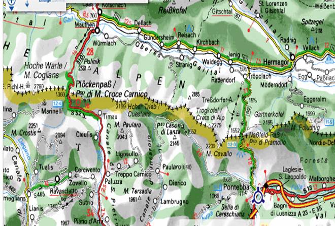
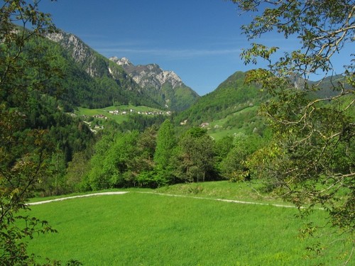 When I have visited mountains in Italy I usuly use their very useful Tabaccos maps. Ponteba have been the origion of our trip. We turn with car through Pontebba directed to Val Pontebbana.The road is narrov, steep and winds uphill in a series of long hairpin bends. Somwhere incline exced 18 percent.Target is Passo del Cason di Lanza wich is possible starting point for slope on Monte Zermulaor other Carnian mountain. From Pontebba to Passo approximate 30 minuts (if the road is open).
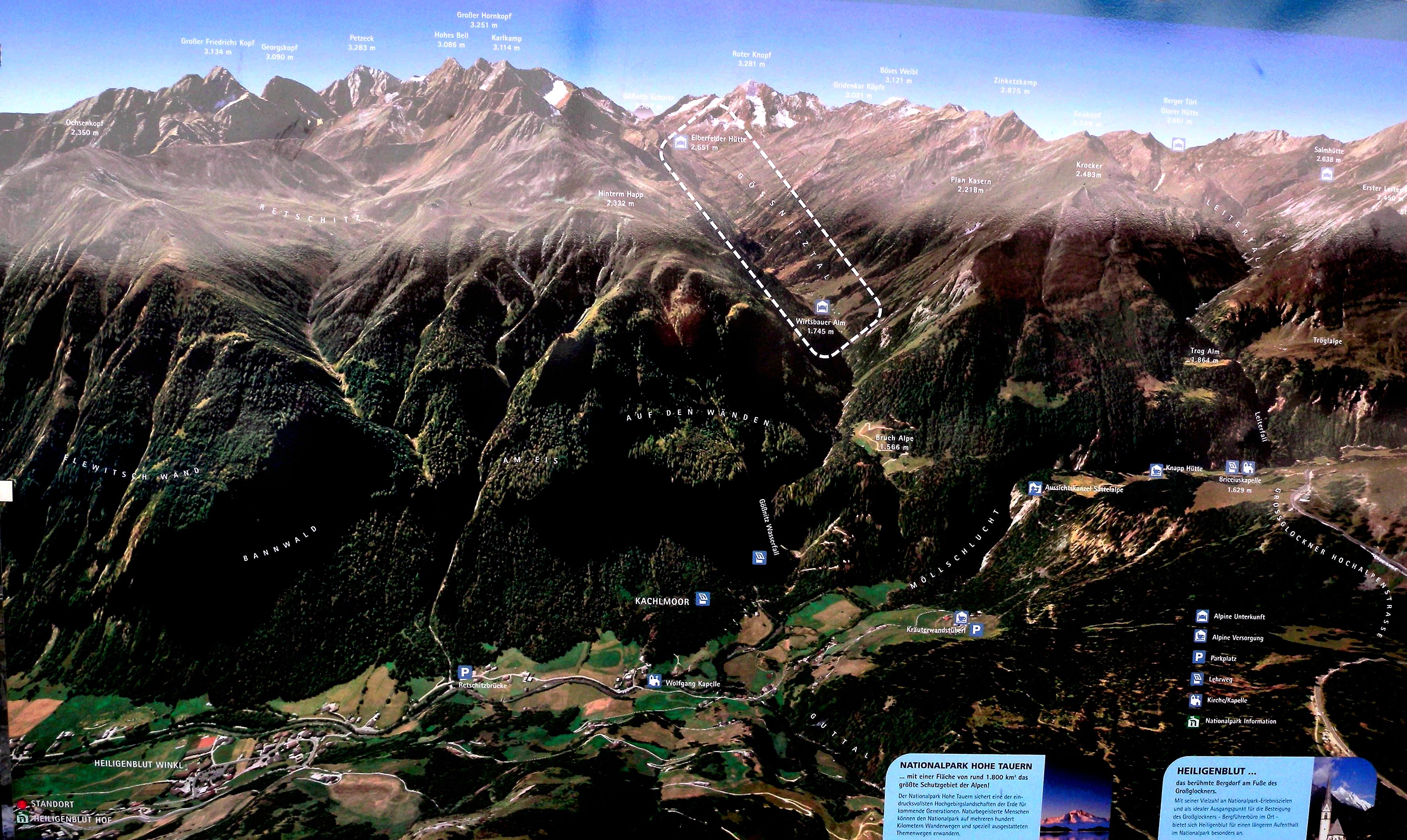
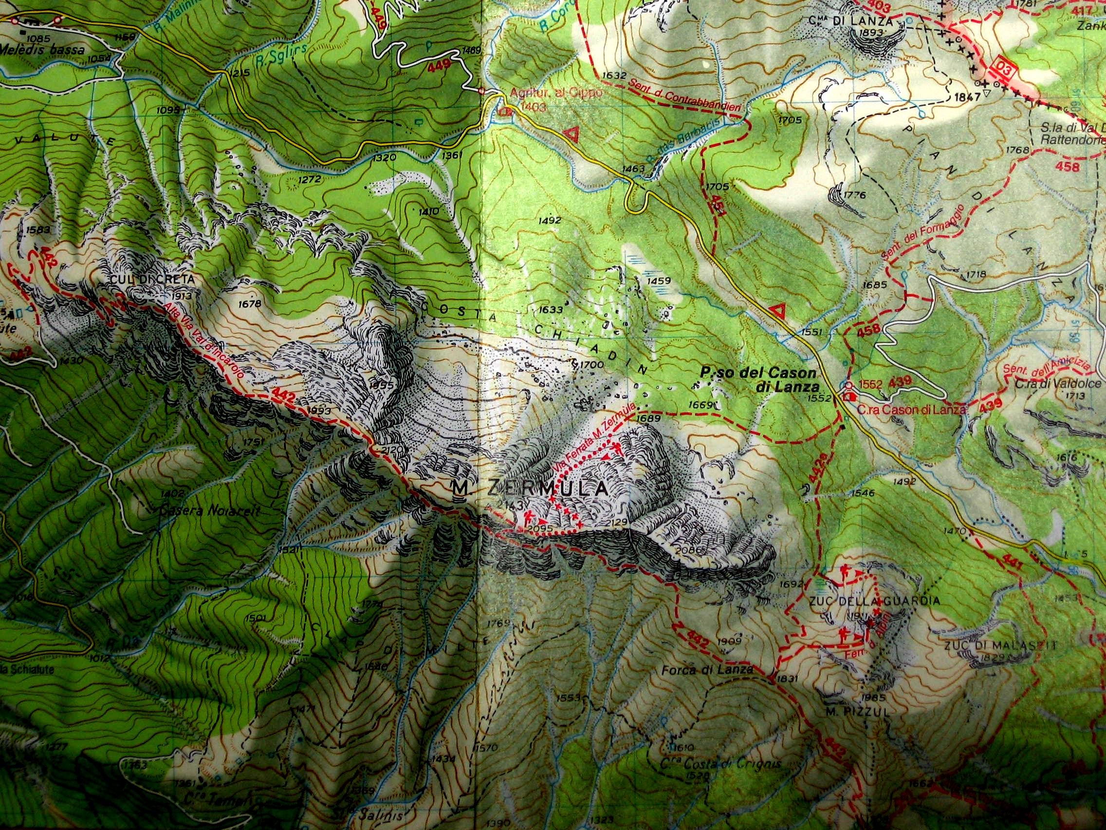
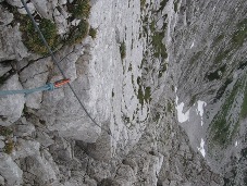
We can reach Passo del Cason di Lanza (1552m) through Val Pontebbana by aproximatly 18 kilometer narrow and on some places steep road. When arriving on Passo del Cason try to find sign for path 442 – ferrata Zermula. Looking from parking place into direction of crest Zermula you will catch the sign of the path – Ferrata Zermula.Through pine and fir wood the path first goes uphill and then easly along of crest in west direction. We need aproximatly 30 minutes to reach the foothill of the crest Zermula which lies at the height of forest border..We continue walking along and round crest untilwe arrive the gravely gable. Now we see the cross at the top of Mount Zermula.There in direction of the top and at the end of gravel is entry of ferrata. From Passo del Cason di Lanza to the entry of ferrata we need 60 minutes.
Monte Zermula via normala
 On the marshiness meadow Cjadin di Lance on crossroads we directed right to the
  Forca di Lanza. The left path going up on Zuc della Guardia and descent over short ferrata Via di Guerra. If you have intention to climb up then i wil prefer direction of slope over Via di Guerra and descent over light path to the basin Cjadin di Lance - but about this on next tour. On saddle Forca di Lanza (1831m) turn to the right over meadov. We are going up to the mulatiera which crossig south slope of Monte Zremula. Walking at hillside over extensive grassy of Zermula enjoy in great view on west Julian Alps with Montassio in foreground. On south Grauzeria and Sernio catch sight of. By small chapell turn right uphill and after some turnes we reach the summit. Now we look also on north side where ridge of Creta di Aip (Trogkofel) raise up. To the top of MonteZermula we need two hours. Don t run back. Just take one's time and enjoy here.
Ferrata Zermula
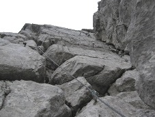
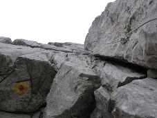 Pictures on the left shows that ascent over ferrata is serious act.
Through pine and fir wood the path first goes uphill and then easly along of crest in west dir
Pictures on the left shows that ascent over ferrata is serious act.
Through pine and fir wood the path first goes uphill and then easly along of crest in west dir
ection. We need aproximatly 30 minutes to reach the foothill of the crest Zermula which lies at the height of forest border..We continue walking along and round crest until we arrive the gravely gable. Now we see the cross at the top of Mount Zermula. There in direction of the top and at the end of gravel is entry of ferrata. From Passo del Cason di Lanza to the entry of ferrata we need 60 minutes.
The begining of ferrata goes towards summit over the west side of wall. When we overcome first allmoast vertical part (60m) we turn to the left and crosses the wall to the next step. The first part is probably one of the hardest part of ferrate, and you need to
put a lot of strength on that part. A lot of airyty, incline and searching for
climbing grips get us pretty bussy, thats why we are very quickly out of that
part.
 It follows a bit gentle part on wich we are crossing to the left.
Steelgrips in direction of the summit are showing us a new path, and
It follows a bit gentle part on wich we are crossing to the left.
Steelgrips in direction of the summit are showing us a new path, and
now you can see that the way out of ferrate wont be in direction of the summit,
but somewhere on the ridge.
Now you can enjoy pretty easy climbing in solid rock. On the top of the second
part you can sort of see the way out in direction of Cross on the ridge But,
what a suprice, a crossbar in the left leads directly in to very gradient
mountain slope. In the ravine under gradient rocks restrains sometimes in late
spring also a bit snow. This is the third part of path. A whole different
callenge is gradiency and very difficult, sharp rocks. Our legs are searching
from water excavated furrows and hands are holding steelgrip and searching for
some grips in holes on the rock. Rough rock surface is holding very good and in
the zigzag we are following steelgrip and also searching for suitable grips. At
that time we are pretty high. Cross on the summit is looking near, now you can
climbing path. Steelgrips are leading in the direction of the rock ťroglaŤ on top of the ridge. Exactly the right inclinety offers you enjoyable and beautiful climbing to the ridge. Under the ridge, is waiting a little tin box with a register book. There is not a lot of guests registered in this book. Just a short climb to the ridge, you can look beyond and breathe flagranted air of heated meadows. From entrance in ferrato to the ridge take a less than an hour: Now there is just a short walk on the ridge path to the meadow cone. And in ten minutes we step on the summit. We descend on the ridge path, by way out of ferrata and by ťkavernŤ. This path is full off beautiful outlooks and at the end of the ridge its pretty hard to let loose on the mountain saddle Forca di Lanza (1831 m).
Essential Gear: selfsecure gear, hellmet.